Notice of Thermal Imaging Drone Survey south of the M40, 3-6 Feb
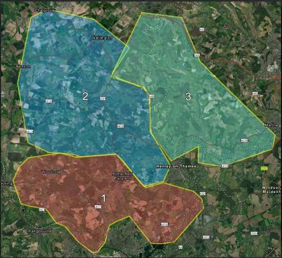
A thermal drone survey of deer is being undertaken this week across the southern Chilterns (south of the M40). The numbers on the map indicate the order in which areas will be covered from Monday, 3 February until either Wednesday, 5 or Thursday, 6 February (weather dependent).
Published: 4 February 2025
The survey is not covering all land within these zones, only the land where landowners have agreed to participate. The surveyors typically work from field or woodland entrances and fly over the land from these points.
Deer can negatively impact woodland regeneration, and the survey is being undertaken to further understand the numbers, distribution, species, and sex ratio of the deer in the area.
Please read the attached document for further information on the survey method.
We hope this information will be of help in the event that the public contact you with concerns about drone activity. The police, MoD and HMP Huntercombe have also been informed.
The consultancy team working on the survey are as follows:
Ben Harrower – Grey Ford Ranger – SY24 VPZ
Robert McCreath – Black Ford Ranger – SR69 CLZ
Glen Poland – White VW Amarok – NG64 XEN
Jordan Tiernan – Black Ford Ranger – HN71 NFG
David Recchia – Skoda Octavia – D19REC
If you have any questions about the survey, please contact BH Wildlife Consultancy, (bhconsultancy@outlook.com) or Gareth Clay, Chilterns National Landscape (gclay@chilterns.org.uk)